
How to Plan a Self-Guided Tour of a National Park
This post contains affiliate links. As an Amazon Associate, we earn from qualifying purchases.
To plan a self-guided tour of a national park, pick one park, read its Plan Your Visit and Basic Information pages, download the NPS App content for offline use before you leave home, and file a trip plan with someone who isn’t coming. A paper map covers everything the phone can’t.
Offline is the load-bearing word in that sentence. The NPS App can hold entire parks on your phone, and that’s genuinely useful right up until you’re standing at a trailhead with one bar of signal and a fading battery. Everything below exists to keep that gap from eating a day.
What follows is the order I actually work in: research first, download second, paper backup third, trip plan fourth, and one unscheduled block built in on purpose.
Key Takeaways
- Download park content before you leave home, not at the trailhead. Remote parks have nothing to pull from.
- Your phone can’t replace the 10 essentials. NPS says the battery may not last the whole trip.
- File a trip plan with someone who isn’t coming, and ask them to call authorities if you’re late.
- Stay 25 to 50 yards from most wildlife and 100 yards from bears and wolves.
- Pack a whistle for every person, kids included. It works after your voice gives out.
What Does a Self-Guided Tour Actually Require Before You Leave?
The how to plan a self-guided tour of a national park question starts on the park’s own website, not in a forum thread. NPS publishes an NPS trip planning guide that covers day and overnight trips, and it’s the same checklist rangers hand out when they tell you to plan like a ranger.
The National Park Service Trip Planning Guide is written for day and overnight trips to a park. Multi-day trips, especially into backcountry areas, require additional planning steps that fall outside the guide’s scope. Rangers point those visitors toward separate backcountry resources rather than the standard day-trip checklist, and the distinction matters for anyone planning more than a single night out.
Four things decide whether your day works: amenities, weather, wildlife, and alerts. NPS lists them in that order, and the order is deliberate.
- Amenities: does the park have drinking water, shuttles, or a store where you can buy food and gear?
- Weather: what’s the forecast for the length of your trip, and how will you prepare for it?
- Wildlife: which animals live in the park, and what does a chance encounter actually look like?
- Park alerts: closures, hazards, and anything else active that changes your route.
The Two Pages Worth Reading Twice
Plan Your Visit and Basic Information. Those two pages carry things to do, maps, calendars, directions, brochures, and operating hours, plus the safety basics that keep a visit from going sideways.
Read both pages twice.
If your activity needs a permit, you’ll find that under Plan Your Visit too, along with the park’s own instructions for applying and obtaining one. Ranger-guided and Junior Ranger programs live on those pages as well, and a national park day trip built around one ranger program in the morning and your own route in the afternoon beats a full day of wandering.
I spend time on a park’s site before I commit to anything. The alerts page is the one that changes my plan most often.
The national park hiking gear you need depends on the terrain, and the park’s own trail descriptions tell you what that terrain is.
Skip the third-party roundups. They go stale within a season and they never carry closures.
The Offline Download Step Most People Get Wrong
This is the step that gets skipped.
I downloaded an offline map of a park before a trip where I lost signal. It did exactly what it promised. On the trip I forgot, I walked the wrong way down a fire road before I noticed the sun was on the wrong side.
The NPS App works differently from a normal map app. Open a park site and the download button sits in the upper right corner, and it pulls content for the entire park rather than the trails you tapped.
The official NPS app page lists what comes down with it: interactive maps, self-guided tours, accessibility information, amenities, news, alerts, and events.
Two conditions matter more than the button itself. Download before you leave home if the park is remote, and do it on strong wifi.
| Symptom | What’s Happening | Fix |
|---|---|---|
| Download stalls at zero | Weak signal at the trailhead | Download at home on wifi |
| Map opens to a blank grid | Park content was never saved | Open the park page, tap download |
| Saved lists vanish on a new phone | Downloads don’t transfer | Rebuild the lists before you travel |
| No audio tour on the drive | Phone isn’t connected | Plug into CarPlay, pick a tour |
That last row deserves its own sentence. Plug your phone into CarPlay, open the app, and pick an audio driving tour or a podcast. It’s a ranger in the passenger seat for the drive in.
Here’s the gotcha nobody warns you about. If you delete the app or move to a new device, your saved lists and downloaded parks don’t transfer. NPS says your saved lists and downloaded parks will not transfer. Until it lands, you rebuild from scratch.
That’s the argument for treating digital maps for self-guided travel as a habit rather than a one-time download.
Your phone screen at full brightness in direct sun reads as a grey mirror. You’ll tilt it, cup it with your hand, and still lose the trail line.
Download on hotel wifi the night before you fly. Doing it at the gate on one bar is a coin flip you don’t have to take.
Do it at home.
Where this goes sideways: Downloading at the trailhead. Remote parks have no signal to pull from, so the progress bar sits at zero while the daylight goes.
Paper Maps, Dead Batteries, and the Skill Nobody Practices
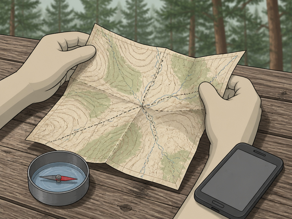
Two miles into a how to plan a self-guided tour of a national park, the screen shows a grey rectangle and a spinning circle. The junction is somewhere ahead in the trees, and your map is folded in a back pocket.
NPS is blunt about the phone. Your cell phone is not a substitute for any of the 10 essentials, and you may not have service in the park at all. The battery may not last the trip either.
Finding your way without a phone or GPS is a skill, and it’s one you can practice at home. NPS suggests making your own compass and using it in your yard or neighborhood before trying something bigger.
The NPS mapping your journey guide covers paper navigation, ADA-accessible maps for visitors with vision impairments, and ranger-built trip ideas in one place.
| Navigation Tool | Best For | Fails When |
|---|---|---|
| NPS App | Route detail, tours, amenities | Battery dies or signal drops |
| Paper map | Backup when everything else quits | It’s sitting in the trunk |
| Visitor center map | Current road and trail conditions | You arrive after closing |
| Park ranger | Conditions nobody published yet | You don’t ask |
A paper map that’s been folded and refolded goes soft along the crease, and the ink fuzzes first at exactly the junction you need.
Accessibility labels are optimistic. I’ve seen a wheelchair-accessible trail that meant a paved loop, and another where it meant a gravel path with a steep grade. Look for the surface type and the grade number instead of the label.
The accessible shuttle at some parks is a separate vehicle you request in advance. Show up expecting to roll onto the regular shuttle and you’ll watch it leave with your group.
A park like Olympic National Park rewards the same approach: read what the park publishes, then plan around the surfaces you can actually handle.
A paper map is the only navigation tool that still works after a battery dies, a screen cracks, or a river crossing soaks your pack. Carry one even when the app is fully loaded.
Paper doesn’t need charging.
The Trip Plan Someone Else Can Actually Act On
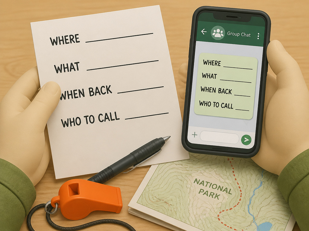
Who is going to notice you’re missing?
I once spent an afternoon building a beautiful shareable itinerary in Notion for a group trip. Nobody opened it. What the group actually used was a screenshot of a hand-written list in the group chat.
Now I send a one-page PDF with times and addresses. No commentary, no links, no long context notes. People read it, and I’ve stopped pretending anyone wanted the commentary.
Tell a trusted contact who isn’t going on the trip where you are, what you’re doing, and when you’ll be back. Then ask them to call authorities and share your plan if you’re not back on time.
Four lines carry the whole document:
- Where you’re going, in specific terms
- What you’re doing there
- When you’ll be back
- Who to call if you’re not
Whistles, Buddies, and Group Discipline
Pack a whistle for every person, kids included. NPS points out that blowing a whistle helps search parties find you, and a whistle cuts through wind and moving water in a way a shout doesn’t.
If you’re traveling with a group, stay together. If you have to split off, use the buddy system, because separation is how people end up lost or injured.
I don’t hand out a trip plan and then go quiet. If the route changes, the person holding the plan hears about it that day. A plan nobody updates is worse than no plan at all, because it sends searchers to the wrong trailhead.
A national park trip with kids raises the stakes on all of this. The group moves slower, the whistle rule stops being optional, and the plan needs a second copy with someone at home.
Update the plan or it’s fiction.
How Close Is Too Close to Wildlife in a National Park?
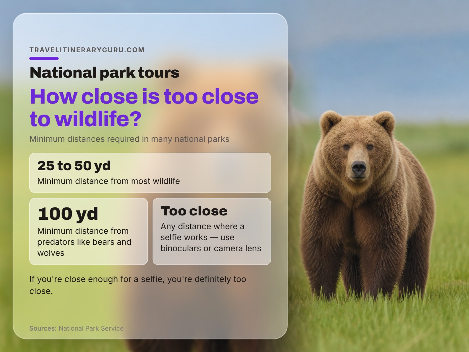
The distance rule is 25 to 50 yards for most wildlife and 100 yards for bears and wolves.
| Animal Group | Minimum Distance | Practical Read |
|---|---|---|
| Most wildlife | 25 to 50 yards | Watch with binoculars |
| Bears and wolves | 100 yards | Give them the whole meadow |
| Any distance where a selfie works | Too close | Use the camera zoom |
NPS puts it plainly. If you’re close enough for a selfie, you’re definitely too close. Use binoculars or a camera lens and leave the animal alone.
The NPS travel tips page adds the wider version: keep your distance, and stay aware of how your actions affect plants, animals, other people, and entire ecosystems.
Check the forecast for the length of your trip, not just the morning you arrive. Weather is also one of the three self-assessment questions NPS asks before you pick an activity, alongside your skills and how often you recreate outdoors.
NPS flags altitude as one of the reasons to check with a physician first, along with weather and physical exertion. The park has no idea what your medical history looks like.
Building a Backup Day You’ll Actually Take
Choose your backup activity before you need one. Forecasts shift, lots fill, areas close, and sometimes you just don’t feel up to the plan you built.
Indoor options do the job best:
- Park museums
- Historical buildings
- Interpretive exhibits
All three involve light physical activity and need no special gear, which is what makes them real backups instead of consolation prizes.
The part nobody mentions: Backups chosen at the trailhead are backups you won’t take. Decide the indoor option the night before, while you’re still objective about the weather.
And if something doesn’t feel right, don’t do it. NPS says that directly, and it’s the one rule that outranks your itinerary.
Turn around early.
How to Plan a Self-Guided Tour of a National Park, Step by Step
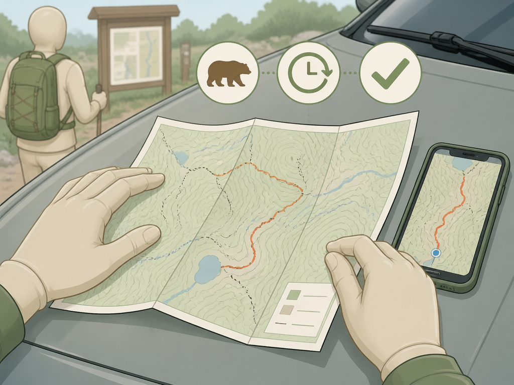
The whole thing runs in steps, and the order matters more than the detail.
Before you start: You may not have cell service in the park, so carry a paper map as your backup. Heat and altitude hit harder than the mileage suggests, so set a turnaround time before you leave the car. Wildlife distance rules are park rules, so hold 25 to 50 yards from most animals and 100 yards from bears and wolves.
- Pick one park and read its Basic Information page. Skip it and you’ll learn about the closed road from a sign at the gate.
- Read Plan Your Visit for things to do, maps, hours, and permits. Miss the permit step and your activity doesn’t happen, however good the rest of the plan is.
- Check park alerts, the full-trip forecast, and which animals live there. A closure you didn’t read about turns a drive into a parking lot.
- Download the park’s content in the app before you leave home, on strong wifi. Do it at the gate and you’ll watch a progress bar while the daylight goes.
- Carry a paper map in a pocket, not the trunk. A map in the trunk is a map you don’t have when the battery dies.
- File a trip plan with someone who isn’t coming, and set a check-in time. Without one, nobody calls anybody, and the search starts hours late.
- Pick your backup activity and turnaround time before you start walking. Without a turnaround time, one more viewpoint is how a day hike becomes a night hike.
A self-guided tour rewards the reading you did before you left the house.
If you’re staying overnight, booking a campsite runs on its own clock, and Recreation.gov is the channel NPS names for tours and campgrounds. Entrance fees and timed entry vary by park, so check ahead and look at the America the Beautiful pass if more than one park is on your list.
The official self-guided tour resource shows the shape of a finished route: a map from the visitor center or the app, then a stop list you walk in your own order.
One NPS historic site keeps its grounds open 24 hours a day and hands you a stop list that runs from a Birthplace Cottage to a Gravesite. That’s the level of specificity a route reaches.
Visitor centers carry maps, guides, and Junior Ranger activity books, and you can borrow a tablet if you’d rather not use your own phone.
Ask a ranger while you’re there. NPS calls them some of the most knowledgeable people you’ll meet on your travels.
Worth the stop.
Frequently Asked Questions
Do I need the NPS App to plan a self-guided tour?
No, but it does the heavy lifting. The app is free for iOS- and Android-powered devices through the App Store and Google Play, and it was created by park rangers. It carries interactive maps, self-guided tours, amenities, accessibility information, news, alerts, and events in one place.
Can I rely on my phone for navigation in a national park?
Not on its own. NPS states that a cell phone is not a substitute for any of the 10 essentials, that you may have no service in the park, and that the battery may not last the whole trip. Carry a paper map as your backup.
How far ahead should I plan a self-guided tour?
Enough time to read the park’s Plan Your Visit and Basic Information pages, check alerts and the forecast, and confirm whether your activity needs a permit. If the park is remote, download the app content before you leave home, ideally on strong wifi.
Are self-guided tours free?
The NPS App is free. Park entry is separate, and some parks charge fees for entrance, tours, or parking. Some parks also require timed entry or reservations, so check ahead and look at entrance pass options if you’re visiting more than one park.
What if the weather turns during my visit?
Switch to your backup activity. NPS recommends choosing one in advance, and indoor options like park museums, historical buildings, and interpretive exhibits involve light physical activity and need no special gear.
Do I need a permit for a self-guided tour?
Sometimes. Check under Plan Your Visit for your specific activity, then follow the park’s own instructions for applying and obtaining one. Multi-day and backcountry trips need additional planning that falls outside the standard Trip Planning Guide.
The Bottom Line
Here’s the change I’d make if I were starting over: do the app download the same night you book the trip, not the night before you leave. It’s the step that’s easiest to lose in the shuffle, and losing it puts you in a parking lot watching a progress bar.
If your self-guided tour of a national park runs longer than one night, or it heads into backcountry, the standard checklist stops being enough. NPS says those trips need planning steps beyond the Trip Planning Guide, so treat a multi-day route as a separate project with a separate list.
And keep one afternoon clear of reservations. I’d take that over a packed schedule every time, because the unscripted hours are where the trip happens.
Start with the park’s own website tonight. Everything else follows from there.
