
How to Plan a Great Barrier Reef Trip: Step-by-Step
This post contains affiliate links. As an Amazon Associate, we earn from qualifying purchases.
To plan a Great Barrier Reef trip, start with the zoning map for the area you’re visiting. The Marine Park runs under the Great Barrier Reef Marine Park Zoning Plan 2003, and four Plans of Management (Cairns Area, Hinchinbrook, Whitsundays and Shoalwater Bay) control vessel length, group size and access.
That order matters to how to plan a Great Barrier Reef trip because the map decides which operators can take you where you want to go. A liveaboard running out of Cairns works inside the Cairns Area Plan of Management, so its itinerary is shaped by group size settings and anchorage locations you never see on a booking page. Plan around a site you can’t legally visit and the whole trip has to be rebuilt.
What follows covers the four decisions that shape a Reef trip: which region you base from, which style of trip fits your group, what the rules require you to carry, and when to go given that the two main agencies frame the season differently.
Key Takeaways
- Zoning comes first. Pick up a zoning map from a local bait and tackle shop or download the Eye on the Reef app before you book anything.
- Four Plans of Management (Cairns Area, Hinchinbrook, Whitsundays, Shoalwater Bay) set vessel length and group size rules that override whatever your operator prefers.
- Camping needs a permit displayed on your tent, and bookings can open up to 12 months ahead. School holiday periods fill soon after they open.
- Carry a marine band radio transceiver. Most island camp sites sit out of range for mobile phones.
- The season advice splits. Tourism Australia points to May to October for visibility; the Reef Authority says the Marine Park is visitable throughout the year.
How to Plan a Great Barrier Reef Trip Around the Zoning Map
Every activity in the Marine Park sits inside a zone, and the zone decides what you can do there. The Great Barrier Reef Marine Park Zoning Plan 2003 is the statutory instrument that sets this out, and it provides for a range of uses and activities across the Marine Park.
The Great Barrier Reef Marine Park operates as a multiple-use area under the Great Barrier Reef Marine Park Zoning Plan 2003. Zoning assigns each section of the Marine Park to a use category, and four statutory Plans of Management add regional rules on vessel length, group size, visit frequency, anchorages and motorised water sports.
Those four plans apply to different stretches of coast: Cairns Area, Hinchinbrook, Whitsundays, and Shoalwater Bay (Dugong). Each one closely manages access, tourism operations, visit frequency, private moorings, aircraft landing areas and anchorages.
The Reef Authority’s planning your Reef visit page is the shortest route into the rules that apply to you.
Here’s the order that saves the most rework:
- Pick your region first. Access points run from Cape York in the north to Bundaberg in the south, and no single base covers both. Choose wrong and you’ll spend a day driving instead of on the water.
- Get the zoning map for that region. Grab one from a local bait and tackle shop or open the Eye on the Reef app. Without it you’re guessing at what’s legal.
- Check which Plan of Management applies. Vessel length and group size settings differ between Cairns, Hinchinbrook and the Whitsundays, and a boat that’s fine in one area isn’t fine in another.
- Book a high standard tourism operator. The Reef Authority recommends them for first visits, and they already know the current closures.
- Read the responsible practices before you pack. Learning the anchor rules on the boat is too late.
Coral reefs and seagrass beds are susceptible to anchor damage, which is why designated anchorages exist in the Cairns/Cooktown Management Area.
Order matters.
Which Reef Trip Style Fits Your Group?
Four styles cover almost everything on offer: day tours, liveaboards, bareboats, and island camping. Each one trades freedom for logistics in a different way.
| Style | Best for | Main constraint |
|---|---|---|
| Day tour | First visits, short stays | Fixed sites, fixed timetable |
| Liveaboard | Divers chasing multiple sites | Multi-night commitment |
| Bareboat | Self-sail crews | Un-crewed vessels only |
| Island camping | Self-sufficient travellers | Permit, plus water you carry in |
Day Tours, Liveaboards, and Bareboats: The Real Trade-Off
Day tours win for a first visit. Most Reef tours depart from Cairns Marina or the Cairns Reef Fleet Terminal, and one day gets you out to the reef without committing your whole week.
Liveaboards win if you dive. A multi-night liveaboard out of Cairns puts you on multiple sites and dawn dives the day boats can’t reach.
Bareboats win for sailors who want the wheel. The definition is narrow: un-crewed vessels, motorised or with sail. Want a skipper? You’re booking a charter instead.
I’d skip the fly-and-snorkel combo on a first visit. A scenic flight over the Reef is spectacular, and then you’re back on a boat with the same few hours everyone else gets. Save the flight for your second trip, when you already know what you’re looking at.
What most people get wrong: Treating the Reef as one destination. Access points are scattered between Cape York in the north and Bundaberg in the south, and a trip built around Cairns won’t reach the Whitsundays.
One region, done properly, beats three regions seen from a car. Pick one.
How Do You Actually Get There? Airports and Marinas
Cairns Airport (CNS) sits 5.5 km from the city, and most Reef tours leave from Cairns Marina or the Cairns Reef Fleet Terminal.
- Cairns (CNS): 5.5 km from the city, and the launch point for most day tours.
- Townsville (TSV): 5 km out, and the better base for Hinchinbrook Island.
- Proserpine (PPP): 39 km from Airlie Beach, which puts you at the Whitsundays.
- Bundaberg (BDB): 6 km from town, for the southern end of the reef.
- Hamilton Island (HTI): lands on-island.
Marinas matter as much as airports. Some liveaboard options depart from Trinity Wharf, 500 m from the Marlin Marina. Port Douglas reef tours leave from Crystalbrook Marina in Port Douglas.
The Reef Authority’s Great Barrier Reef access by location page splits the Marine Park into management areas. The Townsville/Whitsundays area alone runs from Mission Beach down to Midge Point, south of Proserpine.
The deep navy of the channel shifts to a pale turquoise, and that colour is the coral shelf under you.
Shortest path to the water.
Camping on a Reef Island Is a Different Sport
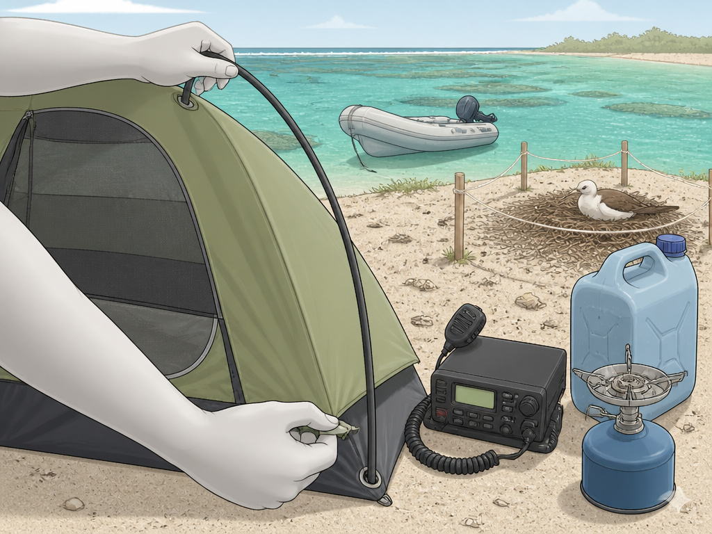
Reef island camping punishes the unprepared.
You can camp on several islands in the Great Barrier Reef, and most are national parks inside the World Heritage Area. The rules are tighter than a mainland campsite, and the consequences are real.
Before you start: Most island camp sites sit out of range for mobile phones, so a marine band radio transceiver is your only call for help. Tides and currents around reef islands run hard, so anchor boats securely and check tidal variation before you swim. Storms and cyclones build fast here, and some camps require evacuation, so take extra supplies in case weather strands you.
Permits, Water, and the Radio You Must Carry
- Get the permit first. You must get a camping permit to display on your tent, and there are fines for camping without one.
- Book early. Bookings can open up to 12 months in advance, and school holiday periods are often fully booked soon after bookings open.
- Carry at least five litres of water per person per day. Few islands have water or facilities.
- Check for seasonal closures. Some islands close seasonally, and some activities are restricted or not allowed.
- Leave the pets at home. Animals, including dogs, aren’t allowed on national parks and most islands and cays.
For cooking, a fuel stove is the requirement. For comms, a marine band radio transceiver covers the requirement.
Search for seabird or turtle nests before you set up camp or start an activity. If you find a nest, move your camp or do your activity elsewhere. Disturbed seabirds leave their nests, and chicks can die of exposure or be taken by predators.
Stay on the walking tracks. Collapsing a shearwater’s nesting tunnel can injure you and trap the chick, and the guidance is to dig the tunnel out so the chick can escape.
The Queensland Government’s camping on the Great Barrier Reef page lists island-by-island facilities, and it’s the page to read before you commit.
Where this goes sideways: Lighting a fire on the beach. Open fires are rarely allowed on reef islands, and fires attract and kill turtle hatchlings.
Carry both or stay on the mainland.
The Fishing Rules Change With the Colour of the Zone
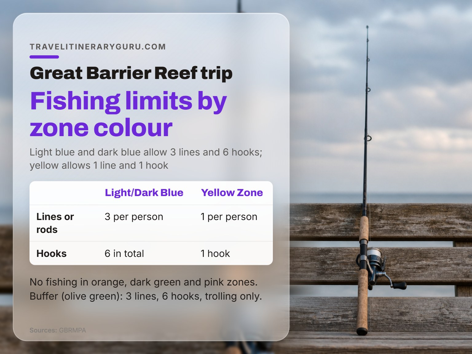
Six hooks is the ceiling in the light blue zone. One hook is the ceiling in the yellow.
The Zoning Plan sets fishing limits by zone colour, and the gap between them is bigger than most visitors expect.
| Zone | Lines and hooks per person | Notes |
|---|---|---|
| General Use (Light Blue) | 3 lines or rods, 6 hooks | Standard recreational rules |
| Habitat Protection (Dark Blue) | 3 lines or rods, 6 hooks | Same limit as General Use |
| Conservation Park (Yellow) | 1 line or rod, 1 hook | Tightest recreational limit |
| Buffer (Olive Green) | 3 lines or rods, 6 hooks | Trolling for pelagic species only |
| Scientific Research, Marine National Park, Preservation | No fishing | Orange, Dark Green and Pink zones |
The Five-Specimen Rule and What It Covers
For many species that don’t otherwise have possession limits, you can only take or possess up to five specimens at any time in the Marine Park unless you hold a Marine Parks permit.
Spearfishing using scuba gear and collecting coral are prohibited. Taking birds or their eggs needs a Marine Parks permit, and “take” covers removing, gathering, killing or interfering with them.
If you can’t name the zone you’re in, you can’t name your limit. Download the zoning map before the rods come out, not after.
The Reef Authority’s responsible Reef practices documentation sets out the legal requirements zone by zone, including the access and speed restrictions at sensitive locations in the Cairns Planning Area.
Refuel on shore wherever possible. Fill portable fuel containers on shore, keep fuel absorbent material on hand for spills, and take fuel-soaked cloth to a hazardous waste facility rather than the bin.
Don’t be that boat.
Where the Sources Disagree on Timing
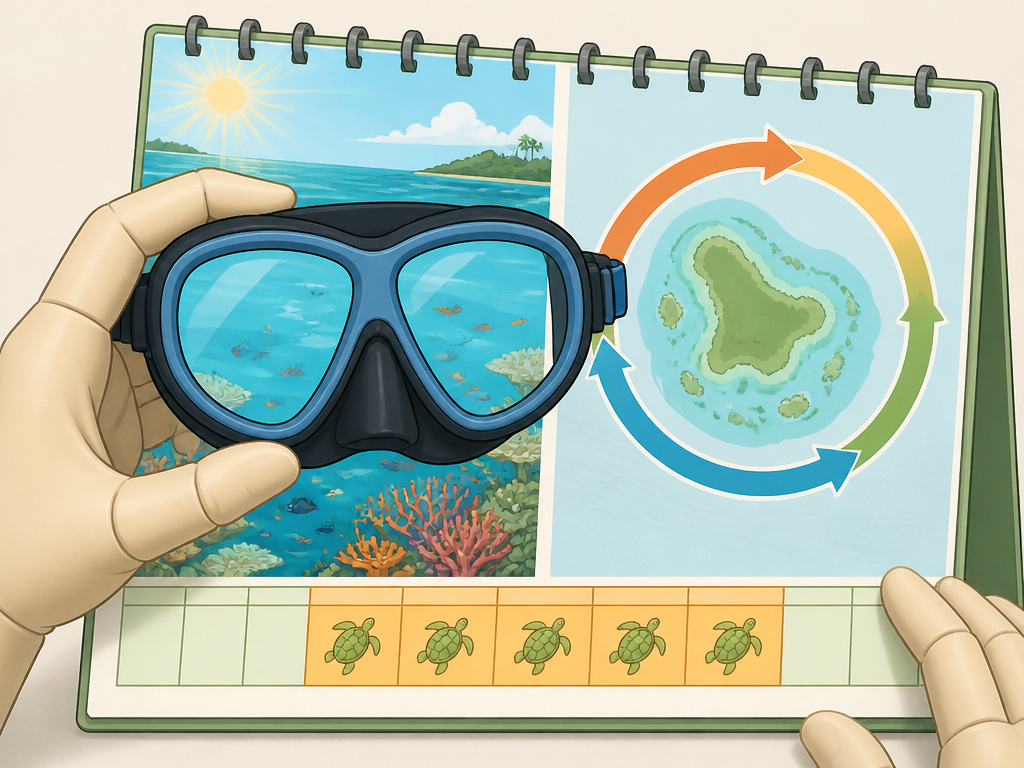
Two government bodies describe the best time to visit the Reef, and they don’t use the same frame.
Tourism Australia says May to October is a great time to visit, because the water is still warm enough for a swim and underwater visibility is at its best. The Reef Authority makes no seasonal recommendation, stating the Marine Park is visitable throughout the year.
| Source | Position | Practical effect |
|---|---|---|
| Tourism Australia | May to October is best: warm water, best visibility | Book this window for snorkel and dive trips |
| Reef Authority | The Marine Park is visitable throughout the year | Access stays open; conditions change |
| Queensland Government | Turtle breeding season runs November to March | Beach lighting restrictions apply |
May to October vs. Year-Round Access
Both positions are correct, and they answer different questions. Tourism Australia is optimising for conditions. The Reef Authority is describing access, which doesn’t close with the season.
The Queensland Government puts turtle breeding season across November to March and warns about beach lighting for that window.
Pick your window, then pick your region.
The Mistakes That Get Visitors Fined, Stranded, or Evacuated
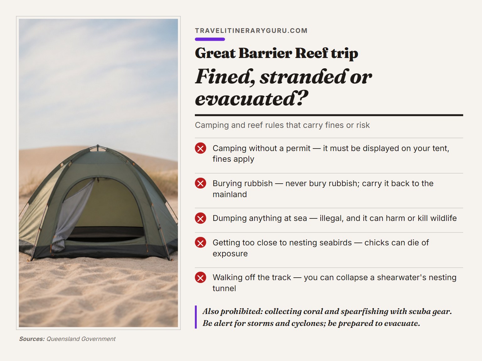
Three things do the damage: an unpermitted tent, a dead radio, and weather that turns while you’re offshore.
- Camping without a permit. The permit must be displayed on your tent, and fines apply.
- Burying rubbish. Never bury rubbish. Bury human waste above the high tide level when there are no toilets, and carry everything else back to the mainland.
- Dumping anything at sea. It’s illegal, and it kills.
- Getting close to nesting seabirds. A disturbed bird leaves the nest, and the chick can die of exposure or be taken by a predator.
- Walking off the track. You can collapse a shearwater’s nesting tunnel and trap the chick inside.
- Collecting coral or spearfishing with scuba gear. Both are prohibited.
Weather is the one you can’t plan around. Be alert for sudden changes, particularly storms and cyclones, and be prepared to evacuate if necessary. Take extra supplies in case you get stranded.
Fair warning.
Wear a hat and sunscreen. That reads like filler advice until you’ve spent hours on a deck with no shade.
Frequently Asked Questions
Do I need a permit to visit the Great Barrier Reef?
Not for a normal visit. You need a Marine Parks permit to run a commercial operation, such as providing transport, accommodation or services for tourists. Camping is different: you must get a camping permit and display it on your tent.
What is the best time of year to visit the Great Barrier Reef?
Tourism Australia points to May to October, when the water is still warm enough for a swim and underwater visibility is at its best. The Reef Authority takes a different angle and states the Marine Park is visitable throughout the year. Both are accurate, and they answer different questions.
Can I camp on the Great Barrier Reef?
Yes, on several islands, and most are national parks inside the World Heritage Area. You need a permit, bookings can open up to 12 months in advance, and you should allow at least five litres of water per person per day. Carry a marine band radio transceiver, because most sites are out of range for mobile phones.
Which airport should I fly into for a Great Barrier Reef trip?
Cairns Airport (CNS) is 5.5 km from the city, and most tours leave from Cairns Marina or the Cairns Reef Fleet Terminal. Townsville (TSV) is 5 km out and suits Hinchinbrook. Proserpine (PPP) is 39 km from Airlie Beach for the Whitsundays, and Bundaberg (BDB) is 6 km from town for the southern end.
Can I fish on the Great Barrier Reef?
Yes, in some zones. General Use (Light Blue) and Habitat Protection (Dark Blue) allow up to three lines or rods per person and six hooks in total. Conservation Park (Yellow) allows one line or rod with one hook. There’s no fishing in the Scientific Research, Marine National Park or Preservation zones.
Do I need to know how to swim?
Before You Go
Reef planning rewards the boring decisions. Zone first, region second, operator third. The rest is weather.
One trigger worth setting: if you can’t find the zoning map for your chosen area, don’t book yet. That’s a signal you’ve picked a region you don’t understand well enough to plan around.
Everything above assumes a first visit built around a day tour or a short liveaboard. If you’re running a bareboat, the Plans of Management matter more than anything else here, because vessel length and group size settings are what will actually constrain you.
